NR21 9BQ North Norfolk
Live postcode, introduced January 1980. Ward: Lancaster South. Region: East of England.
Streets
- Tunn Street, Fakenham: 10 addresses
Council tax
What each band costs in North Norfolk in 2026-27: Band D £2,460 a year on average, including the police, fire and any county and parish charges.
| A | B | C | D | E | F | G | H |
|---|---|---|---|---|---|---|---|
| £1,640 | £1,913 | £2,187 | £2,460 | £3,007 | £3,553 | £4,100 | £4,920 |
Homes by band in the neighbourhood around this postcode: most are in band A (40% of about 770 homes).
Planning and heritage
- Conservation area: yes, Fakenham (council page). Extensions, demolition, some windows and doors, and work on trees need consent.
- Listed buildings within 100 m of this postcode: 31.
- Article 4 direction (removing permitted development rights): none recorded, though not every council has published theirs.
- Tree preservation orders: none recorded, though not every council has published theirs.
- Green belt: no.
Listed buildings
- Church of St Peter and St Paul, grade I
- 1 AND 3, OAK STREET, grade II
- 1, HALL STAITHE, grade II
- 1, OLD POST OFFICE STREET, grade II
- 10, MARKET PLACE, grade II
- 11, OAK STREET, grade II
- 12, MARKET PLACE, grade II
- 14, MARKET PLACE, grade II
- 16, MARKET PLACE, grade II
- 18, MARKET PLACE, grade II
- 19, MARKET PLACE, grade II
- 2, OAK STREET, grade II
- 23, MARKET PLACE, grade II
- 24 AND 26, MARKET PLACE, grade II
- 27, MARKET PLACE, grade II
- 28 AND 29, MARKET PLACE, grade II
- 3, OLD POST OFFICE STREET, grade II
- 3, QUAKER LANE, grade II
- 30, MARKET PLACE, grade II
- 4, OAK STREET, grade II
- 5 AND 7, OAK STREET, grade II
- 6, OAK STREET, grade II
- 7 AND 9, TUNN STREET, grade II
- 8 AND 10, OAK STREET, grade II
- CENTRAL CINEMA, grade II
- Fakenham War Memorial, grade II
- MANOR HOUSE, grade II
- NO 17. WALL ABUTTING NO 17 TO SOUTH, grade II
- PENNY WISE, grade II
- THE OLD FIRE STATION, grade II
And 1 more.
Brownfield land registered for housing within 1.0 km
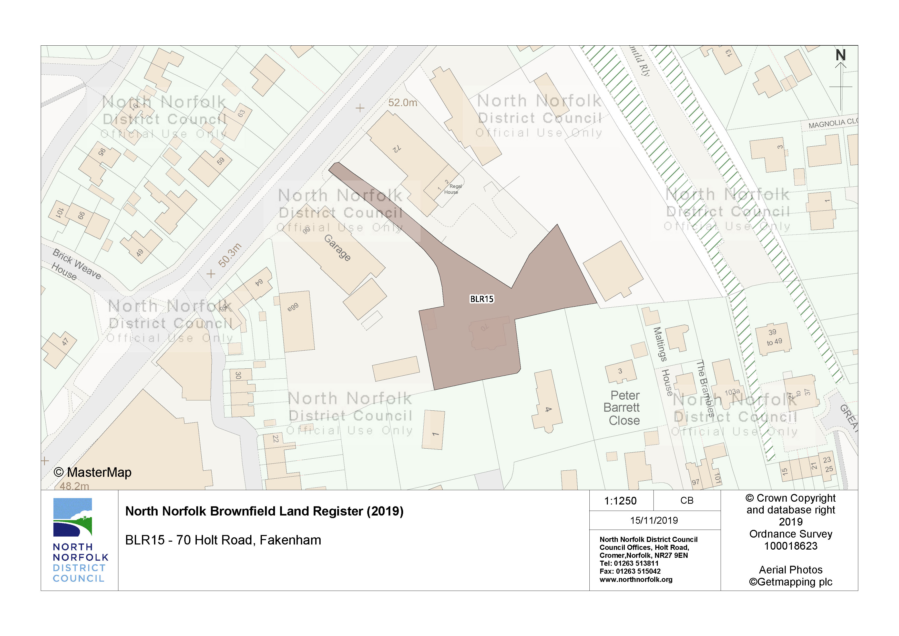
- 70 Holt Road Fakenham, permissioned (750 m)
- Coach Depot Claypit Lane Fakenham, permissioned (780 m)

Flood risk
Rivers, the sea or surface water: in this postcode, 0 addresses are in areas at high risk, 1 at medium risk and 2 at low risk. Each address counts once, at the higher of its rivers-and-sea and surface-water risk.
Rivers and the sea alone: no home is in an area at risk.
High: 3.3% (1 in 30) or more chance of flooding a year. Medium: 1% to 3.3%. Low: 0.1% to 1%. Very low: under 0.1%. The rivers and sea figures allow for flood defences. Counts cover whole postcodes, which can include other streets.
Flood zone for planning: no postcode centre is in flood zone 2 or 3.
Height above sea level
The postcode's 10 addresses are between 37 m and 39 m above sea level (38 m on average).
Broadband
Superfast 100%, ultrafast 89%, gigabit 89% of premises; 0% cannot get 10 Mbit/s. Ofcom Connected Nations, data as at January 2026.
Getting around
| Nearest | Distance | |
|---|---|---|
| Railway station | Sheringham 268,000 journeys in 2024–25 | 27.5 km |
| Bus stops | 9 stops within 400 m, 23 within 800 m; nearest Oak Street Fakenham | 90 m |
| Car parks | 1 within 800 m; nearest Millers Walk Car Park | 260 m |
| EV charging points | MFG Charging Station | 1.8 km |
| Airport with scheduled flights | Norwich Airport NWI | 34.1 km |
| Nearest large airport | London Stansted Airport STN | 113.1 km |
Local services
| Nearest | Distance | |
|---|---|---|
| GP surgeries | Fakenham Medical Practice | 1.8 km |
| Pharmacies | 1 pharmacies within 1.6 km; nearest Boots | 80 m |
| NHS dentists | 2 practices within 1.6 km; nearest Dental Surgery | 150 m |
| Hospital | Wells Community Hospital | 13.9 km |
| Police station | Dereham Police Station | 18.0 km |
Parks and green space
| Nearest | Distance | |
|---|---|---|
| Park or garden | 3 within 800 m; nearest Aldiss Community Park 8,090 m² | 390 m |
| Largest park within 800 m | Fakenham Common 29 ha | 680 m |
| Play area | 4 within 800 m; nearest Unnamed 2,260 m² | 400 m |
| Playing field | 2 within 800 m; nearest Unnamed 1.8 ha | 390 m |
| Allotments | Unnamed 2.0 ha | 1.0 km |
Within 800 m: 3 parks and gardens, 33 hectares in all.
Landmarks
The nearest historic landmark is Church of St Peter and St Paul, a listed building (Grade I), 120 m north-east. 94 listed buildings are within 1.0 km, 1 of them Grade I and 1 of them Grade II*.
| Name | What it is | From the postcode's centre |
|---|---|---|
| Church of St Peter and St Paul | Listed building, Grade I | 120 m north-east |
| Red Lion Hotel | Listed building, Grade II* | 130 m north-east |
| Fakenham gasworks | Scheduled monument | 360 m south |
| Remains of St Stephen's Priory | Scheduled monument | 740 m south |
| Deserted village (site of) | Scheduled monument | 1.9 km south |
| Name | What it is | From the postcode's centre |
|---|---|---|
| Hempton Moor | Wood | 1.6 km west |
| The Carr | Wood | 1.7 km south-east |
| Sculthorpe Moor | Wood | 1.9 km west |
| Great Ryburgh Common | Wood | 2.0 km east |
| Old Squaw Lake | Lake or reservoir | 2.7 km east |
| Beacon Hill | Hill | 3.1 km south-west |
Air quality
| Pollutant | Here | UK limit | WHO guideline |
|---|---|---|---|
| Nitrogen dioxide (NO2) | 4.9 | 40 | 10 |
| Fine particles (PM2.5) | 6.7 | 20 | 5 |
| Particles (PM10) | 11.9 | 40 | 15 |
All three are within the UK legal limits; PM2.5 is above the WHO guideline, as in most towns and cities.
Road and rail noise
| Level | Road traffic | Railways |
|---|---|---|
| 55 to 59 | 3 | 0 |
| Under 55 | 7 | 10 |
3 of the postcode's 10 addresses are modelled at 55 dB or more from road traffic, above the WHO guidelines.
People and work
Who lives here
| Around this postcode | England | |
|---|---|---|
| Median age | 49 | 40 |
| Children under 15 | 9% | 17% |
| Aged 65 and over | 27% | 18% |
Homes
| Around this postcode | England | |
|---|---|---|
| Owned (outright or with a mortgage) | 47% | 61% |
| Owned outright | 33% | 33% |
| Shared ownership | 0% | 1% |
| Social rented | 5% | 17% |
| Private rented | 48% | 21% |
Work and commuting
| Around this postcode | England | |
|---|---|---|
| Adults (16 and over) in work | 56% | 57% |
| Unemployment (of those working or looking for work) | 5% | 6% |
| Retired (of adults) | 31% | 22% |
| Long-term sick or disabled (of adults) | 3% | 4% |
| Work mainly from home (of those in work) | 13% | 32% |
| Travel to work by car or van | 49% | 48% |
| By train, Underground, metro or tram | 0% | 4% |
| By any public transport, including bus | 2% | 8% |
| On foot or by bicycle | 31% | 10% |
| Work within 10 km of home (of those who travel to work) | 56% | 65% |
| Work 30 km or more away | 14% | 8% |
Education and languages
| Around this postcode | England | |
|---|---|---|
| Degree or other higher qualification, Level 4+ (of adults) | 28% | 34% |
| No qualifications | 20% | 18% |
| Apprenticeship as highest qualification | 6% | 5% |
| Main language English (aged 3 and over) | 90% | 91% |
| Cannot speak English well or at all | 2% | 2% |
Deprivation
The neighbourhood around this postcode is in decile 4 of 10 on the English Indices of Deprivation 2025, where 1 is the most deprived tenth of England's 33,755 neighbourhoods and 10 the least.
The full dossier for this postcode's main street is on Tunn Street.