Barton Road Ely, East Cambridgeshire
109 addresses across 9 postcodes (CB7), about 650 m long, classed as a minor road. USRN 12000445.
83 recorded sales since 1995; in 2025 the median was £283,500 across 2 sales. 50 homes have an energy certificate (B: 12, C: 8, D: 19, E: 7, F: 4). 14 addresses on its postcodes are in areas at high or medium risk of flooding from rivers, the sea or surface water. Most homes around it are in council tax band B; Band D in East Cambridgeshire costs £2,485 a year in 2026-27. Gigabit broadband is available to 100% of premises. The nearest railway station is Ely, about 880 m away in a straight line. The nearest park or garden, St Mary's Green, is about 490 m away. Background air pollution in 2024 was 5.6 µg/m³ of nitrogen dioxide and 7.1 of PM2.5, within UK legal limits. Its addresses are 16 to 27 m above sea level. The nearest GP surgery is St Mary's Surgery, about 410 m away. About 1,070 people lived in the census areas around it in 2021; 64% of households owned their home and 50% of adults held a degree or other higher qualification. 11 crimes were recorded within 250 m between September 2025 and August 2026, most often anti-social behaviour.
Sales on this street
| Year | Sales | Median price | Lowest | Highest |
|---|---|---|---|---|
| 2025 | 2 | £283,500 | £282,000 | £285,000 |
| 2024 | 1 | £310,000 | £310,000 | £310,000 |
| 2023 | 5 | £426,000 | £135,000 | £1,150,000 |
| 2022 | 4 | £298,000 | £270,000 | £448,000 |
| 2021 | 3 | £303,000 | £120,000 | £630,500 |
| 2020 | 1 | £625,000 | £625,000 | £625,000 |
| 2018 | 9 | £310,000 | £199,995 | £900,000 |
| 2017 | 2 | £257,500 | £255,000 | £260,000 |
| 2015 | 1 | £260,000 | £260,000 | £260,000 |
| 2014 | 3 | £405,000 | £215,000 | £420,000 |
| 2013 | 1 | £265,000 | £265,000 | £265,000 |
| 2012 | 2 | £192,500 | £140,000 | £245,000 |
| Date | Address | Type | Price | Notes |
|---|---|---|---|---|
| 27 Feb 2025 | 52 CB7 4HZ | Terraced | £282,000 | |
| 29 Jan 2025 | 48 CB7 4HZ | Terraced | £285,000 | |
| 22 Aug 2024 | 56 CB7 4HZ | Terraced | £310,000 | |
| 25 Aug 2023 | 76 CB7 4HZ | Semi-detached | £426,000 | |
| 21 Apr 2023 | FLAT 2, MONTGOMERY HOUSE, 22 CB7 4DE | Flat or maisonette | £135,000 | Leasehold. |
| 4 Apr 2023 | FLAT 3 MONTGOMERY HOUSE, 22 CB7 4DE | Flat or maisonette | £230,000 | Leasehold. |
| 17 Mar 2023 | 30A CB7 4HZ | Detached | £700,000 | |
| 20 Jan 2023 | 16 CB7 4DE | Detached | £1,150,000 | |
| 19 Apr 2022 | FLAT 4, MONTGOMERY HOUSE, 22 CB7 4DE | Flat or maisonette | £235,000 | Leasehold. Not a standard sale (repossession, buy-to-let or transfer). |
| 14 Apr 2022 | 50 CB7 4HZ | Terraced | £276,000 | |
| 1 Apr 2022 | 46 CB7 4HZ | Semi-detached | £320,000 | |
| 11 Mar 2022 | 48A CB7 4HZ | Terraced | £270,000 | |
| 14 Jan 2022 | 32 CB7 4HZ | Semi-detached | £448,000 | |
| 28 Sep 2021 | 44 CB7 4HZ | Terraced | £303,000 | |
| 12 Feb 2021 | FLAT 2, MONTGOMERY HOUSE, 22 CB7 4DE | Flat or maisonette | £120,000 | Leasehold. |
| 19 Jan 2021 | 8 CB7 4DE | Semi-detached | £630,500 | |
| 3 Nov 2020 | 84 CB7 4HZ | Detached | £625,000 | |
| 6 Oct 2020 | 70 CB7 4HZ | Detached | £420,000 | Not a standard sale (repossession, buy-to-let or transfer). |
| 6 Nov 2018 | 60 CB7 4HZ | Terraced | £310,000 | |
| 31 Oct 2018 | 9 CB7 4HZ | Detached | £625,000 | Not a standard sale (repossession, buy-to-let or transfer). |
| 26 Oct 2018 | 78A CB7 4HZ | Detached | £635,000 | |
| 19 Oct 2018 | 6, KINGS ROW CB7 4DD | Terraced | £668,000 | New build. |
| 12 Oct 2018 | FLAT 5, MONTGOMERY HOUSE, 22 CB7 4DE | Flat or maisonette | £270,000 | New build. Leasehold. |
| 31 Aug 2018 | FLAT 3 MONTGOMERY HOUSE, 22 CB7 4DE | Flat or maisonette | £199,995 | New build. Leasehold. |
| 31 Aug 2018 | FLAT 4, MONTGOMERY HOUSE, 22 CB7 4DE | Flat or maisonette | £199,995 | New build. Leasehold. |
| 30 Aug 2018 | FLAT 2, MONTGOMERY HOUSE, 22 CB7 4DE | Flat or maisonette | £107,500 | New build. Leasehold. Not a standard sale (repossession, buy-to-let or transfer). |
| 30 Aug 2018 | FLAT 1 MONTGOMERY HOUSE, 22 CB7 4DE | Flat or maisonette | £107,500 | New build. Leasehold. Not a standard sale (repossession, buy-to-let or transfer). |
| 3 Aug 2018 | WESTMORELAND HOUSE, 5A CB7 4HZ | Detached | £900,000 | |
| 14 Jun 2018 | SUNNINGDALE HOUSE, 5B CB7 4HZ | Detached | £875,000 | |
| 15 Feb 2018 | 66 CB7 4HZ | Semi-detached | £285,000 | |
| 26 Jun 2017 | 64 CB7 4HZ | Semi-detached | £260,000 | |
| 5 May 2017 | 46 CB7 4HZ | Semi-detached | £255,000 | |
| 13 Oct 2015 | 62 CB7 4HZ | Terraced | £260,000 | |
| 10 Oct 2014 | 10 CB7 4DE | Detached | £405,000 | |
| 2 Oct 2014 | 60 CB7 4HZ | Terraced | £215,000 | |
| 17 Mar 2014 | 2 CB7 4DE | Semi-detached | £350,000 | Not a standard sale (repossession, buy-to-let or transfer). |
| 15 Jan 2014 | 6 CB7 4DE | Semi-detached | £420,000 | |
| 24 Jul 2013 | 32 CB7 4HZ | Semi-detached | £265,000 | |
| 4 May 2012 | 48A CB7 4HZ | Terraced | £140,000 | |
| 24 Feb 2012 | 84 CB7 4HZ | Detached | £245,000 | |
| 21 Oct 2011 | 60 CB7 4HZ | Terraced | £154,000 | |
| 19 Oct 2011 | 12 CB7 4DE | Detached | £840,000 | |
| 6 Jul 2011 | 11B CB7 4HZ | Detached | £450,000 | |
| 20 Apr 2011 | 84 CB7 4HZ | Detached | £187,500 | |
| 31 Aug 2010 | 30 CB7 4HZ | Detached | £304,000 | |
| 4 Jun 2010 | 62 CB7 4HZ | Terraced | £176,000 | |
| 21 May 2010 | 5B CB7 4HZ | Detached | £573,000 | |
| 11 Nov 2009 | 8 CB7 4DE | Semi-detached | £321,500 | |
| 8 Jul 2009 | WESTMORELAND HOUSE, 5A CB7 4HZ | Detached | £499,950 | |
| 17 Jun 2009 | 7A CB7 4HZ | Detached | £575,000 |
Energy performance certificates
50 homes with a current certificate; median floor area 111 m². Most common: House, detached (18); House, mid-terrace (8); House, semi-detached (8). Built: 1900-1929 (13); 2016 (11); before 1900 (9). Tenure at assessment: owner-occupied (23); rented (private) (5); rented (social) (1).
Council tax
What each band costs in East Cambridgeshire in 2026-27: Band D £2,485 a year on average, including the police, fire and any county and parish charges.
| A | B | C | D | E | F | G | H |
|---|---|---|---|---|---|---|---|
| £1,657 | £1,933 | £2,209 | £2,485 | £3,037 | £3,590 | £4,142 | £4,970 |
Homes by band in the neighbourhoods around this street: most are in band B (34% of about 1,690 homes).
Planning and heritage
- Conservation area: yes, Ely (council page). Extensions, demolition, some windows and doors, and work on trees need consent.
- Listed buildings on or by this street: 7.
- Article 4 direction (removing permitted development rights): 13-15 (odds) Barton Road, Ely, 18 Barton Road, Ely, 4-24 (evens) Parade Lane, Ely, 56-66 (evens) Barton Road, Ely.
- Tree preservation orders: 5 protected trees on or by this street.
- Green belt: no.
Listed buildings
- BARN AND STOREHOUSE OF THE MONASTERY, grade I
- ELY PORTA, grade I
- 5, SILVER STREET, grade II
- 7-13, SILVER STREET, grade II
- FOUNTAIN PUBLIC HOUSE, grade II
- TELEPHONE KIOSK, grade II
- WALL TO THE BARN AND STOREHOUSE OF THE MONASTERY, grade II
Brownfield land registered for housing within 1.0 km
- Land At Barton Road Car Park Barton Road Ely Cambridgeshire, permissioned (280 m)
- Station Gateway, Angel Drove, Ely: up to 100 homes, not permissioned (740 m)
- Station Gateway, Angel Drove, Ely, not permissioned (740 m)
- Pound Store, 10, Forehill, ELY, Cambridgeshire CB7 4AF, permissioned (850 m)
- Pound Store, 10, Forehill, ELY, Cambridgeshire CB7 4AF, permissioned (850 m)
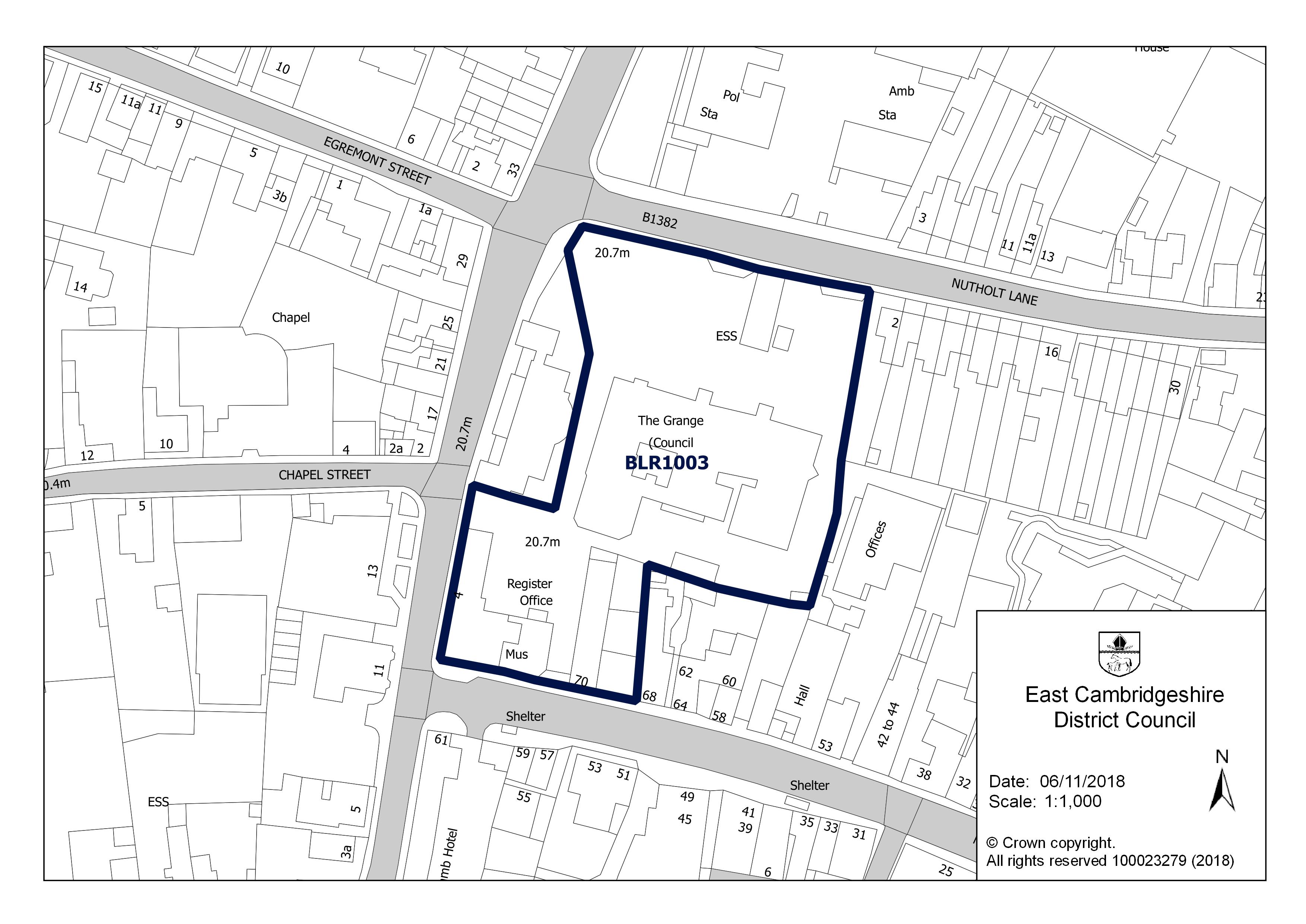
- The Grange, Nutholt Lane, Ely CB7 4EE: up to 10 homes, not permissioned (850 m)
- The Grange, Nutholt Lane, Ely CB7 4EE, not permissioned (850 m)
- Balagowan 34 Downham Road Ely Cambridgeshire CB6 1BL: up to 1 home, pending decision (870 m)


Roadworks
Planned, as of 30 September 2026
- 30 September 2026 to 2 October 2026: CAMBRIDGESHIRE COUNTY COUNCIL, Highway repair and maintenance works, stop/go boards, on the carriageway (minor works)
Flood risk
Rivers, the sea or surface water: in this street's postcodes, 5 addresses are in areas at high risk, 9 at medium risk and 22 at low risk. Each address counts once, at the higher of its rivers-and-sea and surface-water risk.
Rivers and the sea alone: no home is in an area at risk.
High: 3.3% (1 in 30) or more chance of flooding a year. Medium: 1% to 3.3%. Low: 0.1% to 1%. Very low: under 0.1%. The rivers and sea figures allow for flood defences. Counts cover whole postcodes, which can include other streets.
Flood zone for planning: no postcode centre on this street is in flood zone 2 or 3.
| Postcode | Planning zone | Addresses at high / medium / low risk | Groundwater |
|---|---|---|---|
| CB7 4HZ | not in 2 or 3 | 0 / 1 / 0 | unlikely |
| CB7 4DE | not in 2 or 3 | 0 / 1 / 6 | unlikely |
| CB7 4DB | not in 2 or 3 | 0 / 1 / 0 | unlikely |
| CB7 4DD | not in 2 or 3 | 0 / 0 / 0 | unlikely |
| CB7 4JA | not in 2 or 3 | 4 / 4 / 10 | unlikely |
| CB7 4DX | not in 2 or 3 | 0 / 0 / 0 | unlikely |
| CB7 4BY | not in 2 or 3 | 0 / 0 / 5 | unlikely |
| CB7 4HX | not in 2 or 3 | 0 / 2 / 1 | unlikely |
| CB7 4JE | not in 2 or 3 | 1 / 0 / 0 | unlikely |
Height above sea level
The street's 110 addresses are between 16 m and 27 m above sea level (22 m on average); the ground rises about 11 m from the lowest to the highest.
Broadband
| Postcode | Superfast (30 Mbit/s+) | Ultrafast (300 Mbit/s+) | Gigabit | Below 10 Mbit/s |
|---|---|---|---|---|
| CB7 4BY | 100% | 100% | 100% | 0% |
| CB7 4DB | 100% | 100% | 100% | 0% |
| CB7 4DD | 100% | 100% | 100% | 0% |
| CB7 4DE | 100% | 100% | 100% | 0% |
| CB7 4DX | 100% | 100% | 100% | 0% |
| CB7 4HX | 100% | 100% | 100% | 0% |
| CB7 4HZ | 100% | 100% | 100% | 0% |
| CB7 4JA | 100% | 100% | 100% | 0% |
| CB7 4JE | 100% | 100% | 100% | 0% |
Getting around
| Nearest | Distance | |
|---|---|---|
| Railway stations | Ely 2.3 million journeys in 2024–25 | 880 m |
| Soham 66,000 journeys in 2024–25 | 8.4 km | |
| Littleport 252,000 journeys in 2024–25 | 8.6 km | |
| Bus stops | 7 stops within 400 m, 30 within 800 m; nearest Tower Road Ely | 110 m |
| Car parks | Ely Station Car Park | 850 m |
| EV charging points | 7 within 1.6 km; nearest Connected Kerb Charging Stations | 340 m |
| Airport with scheduled flights | London Stansted Airport STN | 56.8 km |
Local services
| Nearest | Distance | |
|---|---|---|
| GP surgeries | 1 practices within 1.6 km; nearest St Mary's Surgery | 410 m |
| Pharmacies | 3 pharmacies within 1.6 km; nearest St Mary's Pharmacy | 480 m |
| NHS dentists | 4 practices within 1.6 km; nearest Enhance Dental | 390 m |
| Hospital | Princess Of Wales Hospital | 2.4 km |
| Police station | Ely Police Station | 910 m |
| Cash machines | 3 machines within 800 m; nearest The Cooperative Food Watford - Carpenders Park, Carpenders Park | 340 m |
Parks and green space
| Nearest | Distance | |
|---|---|---|
| Park or garden | 7 within 800 m; nearest St Mary's Green 1,150 m² | 490 m |
| Largest park within 800 m | Unnamed 9.2 ha | 770 m |
| Play area | 5 within 800 m; nearest Unnamed 1,060 m² | 470 m |
| Playing field | 2 within 800 m; nearest Unnamed 6.2 ha | 510 m |
| Allotments | 1 within 800 m; nearest Canterbury Avenue Allotments 470 m² | 530 m |
Within 800 m: 7 parks and gardens, 17 hectares in all.
Air quality
| Pollutant | Here | UK limit | WHO guideline |
|---|---|---|---|
| Nitrogen dioxide (NO2) | 5.6 | 40 | 10 |
| Fine particles (PM2.5) | 7.1 | 20 | 5 |
| Particles (PM10) | 12.2 | 40 | 15 |
All three are within the UK legal limits; PM2.5 is above the WHO guideline, as in most towns and cities.
Road and rail noise
Noise figures are still being loaded.
Nearest schools
| School | Phase | Ages | Distance | Inspection |
|---|---|---|---|---|
| Ely St John's Community Primary School | Primary | 4–11 | 710 m | No overall grade (Nov 2024, graded inspection without an overall judgement): Quality of education: Good; Behaviour and attitudes: Good; Personal development: Good; Leadership and management: Good |
| Ely College | Secondary | 11–18 | 1.3 km | No published inspection |
| Lantern Community Primary School | Primary | 3–11 | 1.4 km | No published inspection |
| Isle of Ely Primary School | Primary | 3–11 | 1.9 km | No published inspection |
| Spring Meadow Infant School | Primary | 4–7 | 2.0 km | Good (Mar 2024, overall grade under the previous framework) |
Food hygiene ratings nearby
| Business | Type | Distance | Rating | Rated |
|---|---|---|---|---|
| The Nyton CB7 4HZ | Hotel/bed & breakfast/guest house | 90 m | 5 Very good | 5 Dec 2024 |
| Ely City Golf Course Ltd CB7 4HX | Pub/bar/nightclub | 190 m | 5 Very good | 15 Oct 2024 |
| MommyChef / ZimChef CB7 4DE | Takeaway/sandwich shop | 260 m | Awaiting inspection | |
| The Fountain CB7 4JF | Pub/bar/nightclub | 400 m | 4 Good | 25 Nov 2022 |
| Ely Masonic Hall CB7 4JF | Other catering premises | 400 m | Exempt | |
| The Prince Albert CB7 4JF | Pub/bar/nightclub | 400 m | 4 Good | 22 Apr 2026 |
| Domino's Pizza CB7 4EY | Takeaway/sandwich shop | 480 m | 5 Very good | 6 Oct 2026 |
| Poets House CB7 4EY | Hotel/bed & breakfast/guest house | 480 m | 5 Very good | 27 Jan 2026 |
| West End House CB6 3AY | Pub/bar/nightclub | 490 m | 5 Very good | 9 Aug 2018 |
| Co-op CB7 4EY | Retailers - other | 490 m | 5 Very good | 19 Oct 2026 |
Crime within 250 m
| Category | Crimes |
|---|---|
| Anti-social behaviour | 6 |
| Other theft | 2 |
| Other crime | 1 |
| Vehicle crime | 1 |
| Criminal damage and arson | 1 |
Most of these are attached to: On or near Cambridge Road (3); On or near Houghton Gardens (3); On or near Tower Road (2); On or near Elysian Close (2); On or near Cambridge Court (1).
People and work
Who lives here
| Around this street | England | |
|---|---|---|
| Median age | 46 | 40 |
| Children under 15 | 13% | 17% |
| Aged 65 and over | 27% | 18% |
Homes
| Around this street | England | |
|---|---|---|
| Owned (outright or with a mortgage) | 64% | 61% |
| Owned outright | 42% | 33% |
| Shared ownership | under 1% | 1% |
| Social rented | 14% | 17% |
| Private rented | 22% | 21% |
Work and commuting
| Around this street | England | |
|---|---|---|
| Adults (16 and over) in work | 55% | 57% |
| Unemployment (of those working or looking for work) | 4% | 6% |
| Retired (of adults) | 30% | 22% |
| Long-term sick or disabled (of adults) | 2% | 4% |
| Work mainly from home (of those in work) | 47% | 32% |
| Travel to work by car or van | 25% | 48% |
| By train, Underground, metro or tram | 10% | 4% |
| By any public transport, including bus | 11% | 8% |
| On foot or by bicycle | 17% | 10% |
| Work within 10 km of home (of those who travel to work) | 47% | 65% |
| Work 30 km or more away | 14% | 8% |
Education and languages
| Around this street | England | |
|---|---|---|
| Degree or other higher qualification, Level 4+ (of adults) | 50% | 34% |
| No qualifications | 12% | 18% |
| Apprenticeship as highest qualification | 4% | 5% |
| Main language English (aged 3 and over) | 95% | 91% |
| Cannot speak English well or at all | under 1% | 2% |
Deprivation
The 2 neighbourhoods around this street are in deciles 7 to 9 of 10 on the English Indices of Deprivation 2025, where 1 is the most deprived tenth of England's 33,755 neighbourhoods and 10 the least.
What has changed
- Food hygiene ratings Co-op (retailers - other, CB7 4EY) re-inspected, still 5 Very good (rated 19 October 2026) found 31 October 2026
Postcodes on this street
- CB7 4HZ: 50 addresses of 52 in the postcode
- CB7 4DE: 19 addresses
- CB7 4DB: 14 addresses of 24 in the postcode
- CB7 4DD: 11 addresses
- CB7 4JA: 10 addresses of 37 in the postcode
- CB7 4DX: 2 addresses
- CB7 4BY: 1 address of 45 in the postcode
- CB7 4HX: 1 address of 50 in the postcode
- CB7 4JE: 1 address of 9 in the postcode
Nearby streets
Tower Road · Tower Road · Elysian Close · Houghton Gardens · Samuals Way · Militia Way · Mariott Drive · Tower Road · Parade Lane · Walpole Court · Mawson Close · St Marys Court
All the streets in CB7 and across East Cambridgeshire.
What this page cannot tell you
- Whether a particular house is at risk of flooding, subsiding or anything else: the flood map is a model of areas and there is no property-level data here.
- What a home is worth now: sales are historic prices for the homes that happened to sell.
- How safe the street is: crime points are moved to anonymised locations and many crimes are never reported.
- Whether you would get a place at a school: distances are straight lines, not catchments.
- Who lives on the street now: census figures describe the small areas around it in March 2021, during a lockdown.
- How long a journey takes or how often anything runs: transport distances are straight lines to the nearest stops.
- Whether a GP practice is taking new patients, or a dentist new NHS patients.
- How loud a home is inside, or noise from aircraft, industry or neighbours: noise figures are models of road and rail traffic outside, in England only.
How each figure on this page is matched to the street and worked out: methodology.