Deacon's Lane Ely, East Cambridgeshire
67 addresses across 6 postcodes (CB6,CB7), about 320 m long, classed as a local road. USRN 12000489.
- Energy: 46 homes have an energy certificate (A: 1, C: 12, D: 21, E: 10, G: 2).
- Flood: 17 addresses on its postcodes are in areas at high or medium risk of flooding from rivers, the sea or surface water.
- Council tax: Most homes around it are in council tax band B; Band D in East Cambridgeshire costs £2,485 a year in 2026-27.
- Broadband: Gigabit broadband is available to 0% to 100% of premises.
- Transport: The nearest railway station is Ely, about 1.4 km away in a straight line.
- Green space: The nearest park or garden is about 350 m away.
- Air: Background air pollution in 2024 was 6.4 µg/m³ of nitrogen dioxide and 7.2 of PM2.5, within UK legal limits.
- Height: Its addresses are 20 to 22 m above sea level.
- Noise: 3 of its 67 addresses are modelled at 55 dB or more from road traffic.
- Doctors: The nearest GP surgery is St Mary's Surgery, about 820 m away, with 2 practices within 1.6 km.
- People: About 790 people lived in the census areas around it in 2021; 47% of households owned their home and 38% of adults held a degree or other higher qualification.
- Crime: 20 crimes were recorded within 250 m between September 2025 and August 2026, most often anti-social behaviour.
Sales on this street
No sales recorded on this street since January 1995 under this street name.
Energy performance certificates
46 homes with a current certificate; median floor area 71 m². Most common: House, mid-terrace (12); House, end-terrace (6); Maisonette, end-terrace (6). Built: 1900-1929 (14); 1976-1982 (12); before 1900 (9). Tenure at assessment: rented (private) (21); owner-occupied (20).
Council tax
What each band costs in East Cambridgeshire in 2026-27: Band D £2,485 a year on average, including the police, fire and any county and parish charges.
| A | B | C | D | E | F | G | H |
|---|---|---|---|---|---|---|---|
| £1,657 | £1,933 | £2,209 | £2,485 | £3,037 | £3,590 | £4,142 | £4,970 |
Homes by band in the neighbourhoods around this street: most are in band B (45% of about 1,300 homes).
Planning and heritage
- Conservation area: yes, Ely (council page). Extensions, demolition, some windows and doors, and work on trees need consent.
- Listed buildings on or by this street: none.
- Article 4 direction (removing permitted development rights): 1-55 (odds) Deacons Lane, Ely.
- Tree preservation orders: 1 protected tree on or by this street.
- Green belt: no.
Brownfield land registered for housing within 1.0 km
- Swimming Pool Newnham Street Ely Cambridgeshire CB7 4PQ: up to 13 homes, permissioned (180 m)
- Paradise Leisure Centre, Newnham St, Ely CB7 4PQ: up to 50 homes, not permissioned (210 m)
- Paradise Leisure Centre, Newnham St, Ely CB7 4PQ, not permissioned (210 m)
- Police/ Abulance Station, Nutholt Lane, Ely, CB7 4PL: up to 30 homes, not permissioned (280 m)
- Waitrose Car Park area, Brays Lane, Ely, CB7 4QJ: up to 20 homes, not permissioned (360 m)
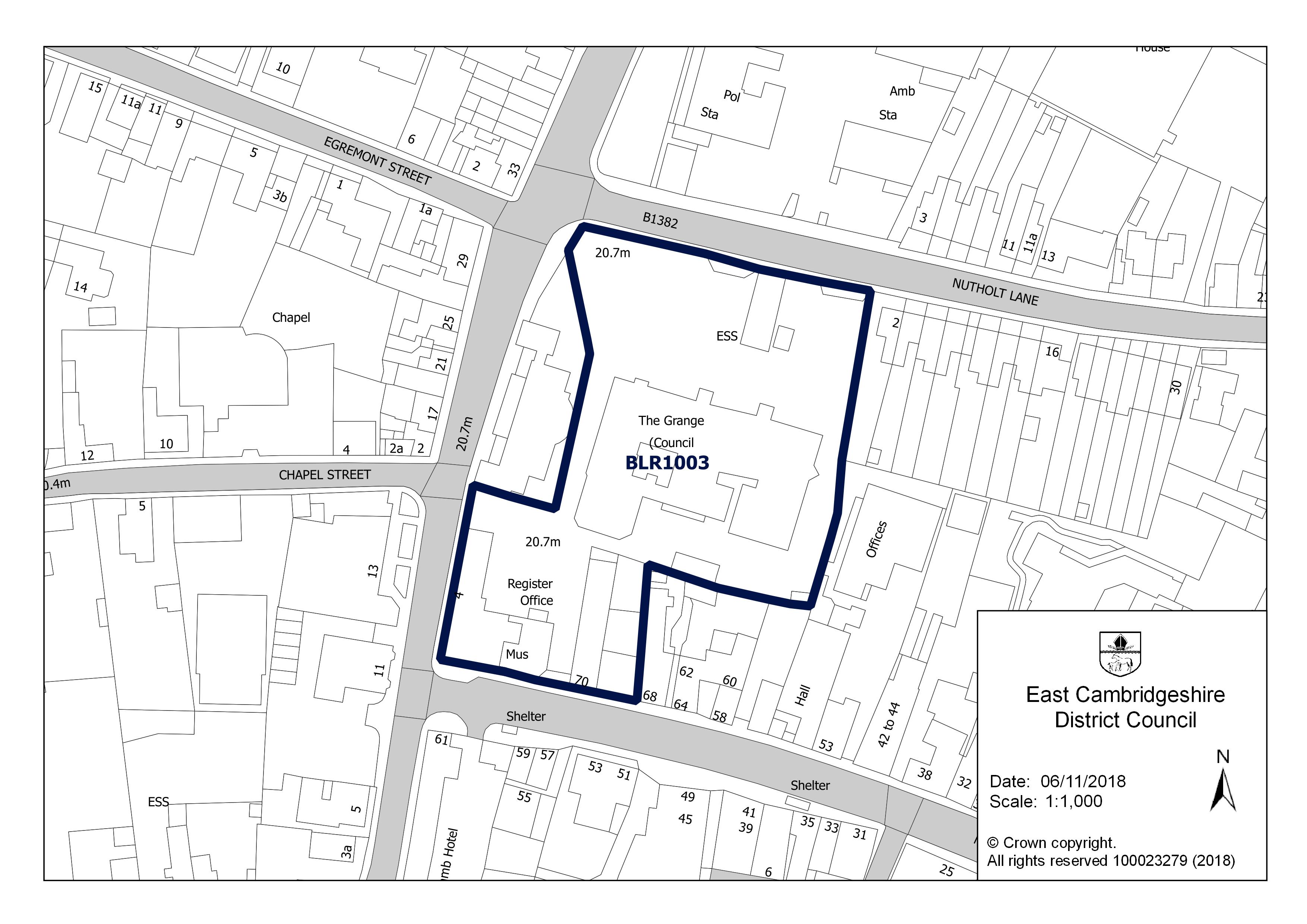
- The Grange, Nutholt Lane, Ely CB7 4EE: up to 10 homes, not permissioned (370 m)
- The Grange, Nutholt Lane, Ely CB7 4EE, not permissioned (370 m)
- Balagowan 34 Downham Road Ely Cambridgeshire CB6 1BL: up to 1 home, pending decision (490 m)

Roadworks
Finished in the last three months
- 23 September 2026: CAMBRIDGESHIRE COUNTY COUNCIL, Highway repair and maintenance works, temp obstruction 15 minute delay, on the carriageway (minor works)
Flood risk
Rivers, the sea or surface water: in this street's postcodes, 14 addresses are in areas at high risk, 3 at medium risk and 22 at low risk. Each address counts once, at the higher of its rivers-and-sea and surface-water risk.
Rivers and the sea alone: no home is in an area at risk.
High: 3.3% (1 in 30) or more chance of flooding a year. Medium: 1% to 3.3%. Low: 0.1% to 1%. Very low: under 0.1%. The rivers and sea figures allow for flood defences. Counts cover whole postcodes, which can include other streets.
Flood zone for planning: no postcode centre on this street is in flood zone 2 or 3.
| Postcode | Planning zone | Addresses at high / medium / low risk | Groundwater |
|---|---|---|---|
| CB7 4PS | not in 2 or 3 | 0 / 2 / 2 | unlikely |
| CB7 4PT | not in 2 or 3 | 12 / 0 / 0 | unlikely |
| CB7 4DU | not in 2 or 3 | 1 / 0 / 6 | unlikely |
| CB6 1DA | not in 2 or 3 | 1 / 1 / 11 | unlikely |
| CB7 4PQ | not in 2 or 3 | 0 / 0 / 0 | unlikely |
| CB7 4RE | not in 2 or 3 | 0 / 0 / 3 | unlikely |
Height above sea level
The street's 67 addresses are between 20 m and 22 m above sea level (21 m on average).
Broadband
| Postcode | Superfast (30 Mbit/s+) | Ultrafast (300 Mbit/s+) | Gigabit | Below 10 Mbit/s |
|---|---|---|---|---|
| CB6 1DA | 100% | 100% | 100% | 0% |
| CB7 4DU | 100% | 100% | 100% | 0% |
| CB7 4PQ | 100% | 100% | 100% | 0% |
| CB7 4PS | 100% | 98% | 98% | 0% |
| CB7 4PT | 100% | 0% | 0% | 0% |
| CB7 4RE | 100% | 100% | 100% | 0% |
Getting around
| Nearest | Distance | |
|---|---|---|
| Railway stations | Ely 2.3 million journeys in 2024–25 | 1.4 km |
| Littleport 252,000 journeys in 2024–25 | 7.4 km | |
| Soham 66,000 journeys in 2024–25 | 8.8 km | |
| Bus stops | 8 stops within 400 m, 44 within 800 m; nearest Deacon's Lane Ely | 60 m |
| Car parks | 1 within 800 m; nearest Forehill Car Park | 700 m |
| EV charging points | 6 within 1.6 km; nearest Newnham Street Car Park | 230 m |
| Airport with scheduled flights | London Stansted Airport STN | 57.8 km |
Local services
| Nearest | Distance | |
|---|---|---|
| GP surgeries | 2 practices within 1.6 km; nearest St Mary's Surgery | 820 m |
| Pharmacies | 4 pharmacies within 1.6 km; nearest Boots | 460 m |
| NHS dentists | 5 practices within 1.6 km; nearest Chequer Hall Dental Practice | 480 m |
| Hospital | Princess Of Wales Hospital | 1.2 km |
| Police station | Ely Police Station | 310 m |
| Cash machines | 1 machines within 800 m; nearest Cashpoint® Minster Place Lloyds Bank | 550 m |
Parks and green space
| Nearest | Distance | |
|---|---|---|
| Park or garden | 5 within 800 m; nearest Unnamed 1.2 ha | 350 m |
| Largest park within 800 m | Unnamed 4.6 ha | 770 m |
| Play area | 3 within 800 m; nearest Unnamed 800 m² | 140 m |
| Playing field | 1 within 800 m; nearest Unnamed 5,710 m² | 490 m |
| Allotments | 3 within 800 m; nearest Unnamed 3.0 ha | 140 m |
Within 800 m: 5 parks and gardens, 9.6 hectares in all.
Landmarks
The nearest historic landmark is Sessions House, a listed building (Grade II*), 380 m south-west. 177 listed buildings are within 1.0 km, 24 of them Grade I and 7 of them Grade II*.
| Name | What it is | From the middle of the street |
|---|---|---|
| Sessions House | Listed building, Grade II* | 380 m south-west |
| Nos. 16 and 18 High Street (including Steeple Gate) | Listed building, Grade II* | 520 m south |
| Almonry, Sacrists Hall, Gate and Goldsmiths Tower the Sacristy Gate and Goldsmith's Tower | Listed building, Grade I | 520 m south |
| Almonry, Sacrists Hall, Gate and Goldsmiths Tower the Almonry | Listed building, Grade I | 540 m south |
| Ely Cathedral: claustral buildings | Scheduled monument | 640 m south |
| 'Cherry Hill', castle mound | Scheduled monument | 920 m south |
| Hospital of St John the Baptist and St Mary Magdalene, St John's Farm | Scheduled monument | 1.0 km south-west |
| Name | What it is | From the middle of the street |
|---|---|---|
| Roswell Pits | Lake or reservoir | 1.2 km east |
| Redmoor Plantation | Wood | 2.9 km north-east |
| Quanea Hill | Hill | 3.2 km east |
| Thorney Hill | Hill | 3.7 km south-east |
| Brick Hill | Hill | 3.8 km north-east |
| The Rookery | Wood | 3.8 km south-east |
Air quality
| Pollutant | Here | UK limit | WHO guideline |
|---|---|---|---|
| Nitrogen dioxide (NO2) | 6.4 | 40 | 10 |
| Fine particles (PM2.5) | 7.2 | 20 | 5 |
| Particles (PM10) | 12.0 | 40 | 15 |
All three are within the UK legal limits; PM2.5 is above the WHO guideline, as in most towns and cities.
Road and rail noise
| Level | Road traffic | Railways |
|---|---|---|
| 55 to 59 | 3 | 0 |
| Under 55 | 64 | 67 |
3 of the street's 67 addresses are modelled at 55 dB or more from road traffic, above the WHO guidelines.
Nearest schools
| School | Phase | Ages | Distance | Inspection |
|---|---|---|---|---|
| Lantern Community Primary School | Primary | 3–11 | 600 m | No published inspection |
| Ely College | Secondary | 11–18 | 680 m | No published inspection |
| Spring Meadow Infant School | Primary | 4–7 | 800 m | Good (Mar 2024, overall grade under the previous framework) |
| Isle of Ely Primary School | Primary | 3–11 | 830 m | No published inspection |
| Ely St Mary's CofE Junior School Church of England | Primary | 7–11 | 890 m | Good (Apr 2023, overall grade under the previous framework) |
| Ely St John's Community Primary School | Primary | 4–11 | 1.7 km | No overall grade (Nov 2024, graded inspection without an overall judgement): Quality of education: Good; Behaviour and attitudes: Good; Personal development: Good; Leadership and management: Good |
Food hygiene ratings nearby
| Business | Type | Distance | Rating | Rated |
|---|---|---|---|---|
| Ely Beet Sports & Social Club CB6 1DD | Other catering premises | 130 m | 5 Very good | 21 Jan 2022 |
| Lily House CB6 1DE | Hospitals/Childcare/Caring Premises | 170 m | 5 Very good | 21 Nov 2025 |
| The Yard By Silver Oak CB7 4PG | Restaurant/Cafe/Canteen | 240 m | 5 Very good | 16 Apr 2025 |
| Ely King CB7 4PN | Takeaway/sandwich shop | 280 m | 4 Good | 19 May 2025 |
| The Atrium CB7 4PQ | Retailers - other | 280 m | Exempt | |
| The High Flyer CB7 4PQ | Pub/bar/nightclub | 280 m | 5 Very good | 30 Oct 2024 |
| City Of Ely Bowls Club CB7 4PL | Other catering premises | 290 m | 5 Very good | 18 Jan 2022 |
| Lunchbox Ely CB7 4PL | Other catering premises | 290 m | 4 Good | 9 Jun 2026 |
| Castle Lodge CB7 4PW | Hotel/bed & breakfast/guest house | 300 m | 5 Very good | 20 Mar 2024 |
| New Barns Convenience Store CB7 4PW | Retailers - other | 300 m | 5 Very good | 10 Sep 2023 |
| Labas CB7 4PE | Retailers - other | 310 m | 3 Generally satisfactory | 8 Dec 2025 |
| Lucky Panda CB7 4PE | Takeaway/sandwich shop | 310 m | 5 Very good | 15 Apr 2025 |
| Waitrose CB7 4QJ | Retailers - supermarkets/hypermarkets | 360 m | 5 Very good | 18 Aug 2026 |
| Acremont House School CB6 1AE | School/college/university | 380 m | 5 Very good | 29 Jun 2026 |
| Hand Crafted Cupcakes CB7 4LS | Restaurant/Cafe/Canteen | 400 m | 5 Very good | 11 Feb 2025 |
Crime within 250 m
| Category | Crimes |
|---|---|
| Anti-social behaviour | 7 |
| Violence and sexual offences | 6 |
| Bicycle theft | 3 |
| Other theft | 2 |
| Other crime | 1 |
| Criminal damage and arson | 1 |
Most of these are attached to: On or near Parking Area (10); On or near Deacon'S Lane (4); On or near Bell Close (2); On or near Meldon Place (1); On or near John Amner Close (1).
People and work
Who lives here
| Around this street | England | |
|---|---|---|
| Median age | 40 | 40 |
| Children under 15 | 19% | 17% |
| Aged 65 and over | 21% | 18% |
Homes
| Around this street | England | |
|---|---|---|
| Owned (outright or with a mortgage) | 47% | 61% |
| Owned outright | 30% | 33% |
| Shared ownership | 0% | 1% |
| Social rented | 28% | 17% |
| Private rented | 25% | 21% |
Work and commuting
| Around this street | England | |
|---|---|---|
| Adults (16 and over) in work | 55% | 57% |
| Unemployment (of those working or looking for work) | 5% | 6% |
| Retired (of adults) | 24% | 22% |
| Long-term sick or disabled (of adults) | 3% | 4% |
| Work mainly from home (of those in work) | 32% | 32% |
| Travel to work by car or van | 42% | 48% |
| By train, Underground, metro or tram | 5% | 4% |
| By any public transport, including bus | 5% | 8% |
| On foot or by bicycle | 20% | 10% |
| Work within 10 km of home (of those who travel to work) | 53% | 65% |
| Work 30 km or more away | 9% | 8% |
Education and languages
| Around this street | England | |
|---|---|---|
| Degree or other higher qualification, Level 4+ (of adults) | 38% | 34% |
| No qualifications | 19% | 18% |
| Apprenticeship as highest qualification | 5% | 5% |
| Main language English (aged 3 and over) | 91% | 91% |
| Cannot speak English well or at all | 2% | 2% |
Deprivation
The 2 neighbourhoods around this street are in deciles 4 to 8 of 10 on the English Indices of Deprivation 2025, where 1 is the most deprived tenth of England's 33,755 neighbourhoods and 10 the least.
What has changed
- Food hygiene ratings Eel & Apple (retailers - other, CB7 4NB) newly listed: Awaiting inspection found 31 October 2026
Postcodes on this street
- CB7 4PS: 49 addresses of 50 in the postcode
- CB7 4PT: 12 addresses
- CB7 4DU: 3 addresses of 11 in the postcode
- CB6 1DA: 1 address of 22 in the postcode
- CB7 4PQ: 1 address of 38 in the postcode
- CB7 4RE: 1 address of 37 in the postcode
Nearby streets
Appleby Park · Bell Close · John Amner Close · Lynn Road · Eden Square · Meldon Place · Little London Gardens · Deacons Lane · Dalton Way · St Audreys Way · New Barns Road · St Audrey's Way
All the streets in CB6, CB7 and across East Cambridgeshire.
What this page cannot tell you
- Whether a particular house is at risk of flooding, subsiding or anything else: the flood map is a model of areas and there is no property-level data here.
- What a home is worth now: sales are historic prices for the homes that happened to sell.
- How safe the street is: crime points are moved to anonymised locations and many crimes are never reported.
- Whether you would get a place at a school: distances are straight lines, not catchments.
- Who lives on the street now: census figures describe the small areas around it in March 2021, during a lockdown.
- How long a journey takes or how often anything runs: transport distances are straight lines to the nearest stops.
- Whether a GP practice is taking new patients, or a dentist new NHS patients.
- How loud a home is inside, or noise from aircraft, industry or neighbours: noise figures are models of road and rail traffic outside.
How each figure on this page is matched to the street and worked out: methodology.