Fieldside Ely, East Cambridgeshire
62 addresses across 6 postcodes (CB6), about 340 m long, classed as a local road. USRN 12000498.
63 recorded sales since 1995; in 2025 the median was £429,550 across 7 sales. 33 homes have an energy certificate (B: 2, C: 5, D: 13, E: 11, F: 2). 17 addresses on its postcodes are in areas at high or medium risk of flooding from rivers, the sea or surface water. Most homes around it are in council tax band B; Band D in East Cambridgeshire costs £2,485 a year in 2026-27. Gigabit broadband is available to 100% of premises. 51 crimes were recorded within 250 m between September 2025 and August 2026, most often violence and sexual offences.
Sales on this street
| Year | Sales | Median price | Lowest | Highest |
|---|---|---|---|---|
| 2025 | 7 | £429,550 | £143,000 | £546,000 |
| 2024 | 1 | £432,500 | £432,500 | £432,500 |
| 2021 | 4 | £401,500 | £275,000 | £720,000 |
| 2020 | 1 | £360,000 | £360,000 | £360,000 |
| 2019 | 2 | £585,000 | £580,000 | £590,000 |
| 2018 | 2 | £330,000 | £280,000 | £380,000 |
| 2017 | 2 | £369,500 | £369,000 | £370,000 |
| 2016 | 2 | £475,000 | £330,000 | £620,000 |
| 2015 | 2 | £382,500 | £315,000 | £450,000 |
| 2014 | 3 | £300,000 | £248,000 | £300,000 |
| 2012 | 2 | £184,975 | £170,000 | £199,950 |
| 2010 | 2 | £254,000 | £233,000 | £275,000 |
| Date | Address | Type | Price | Notes |
|---|---|---|---|---|
| 19 Dec 2025 | 76 CB6 3AR | Semi-detached | £143,000 | |
| 17 Oct 2025 | 78 CB6 3AR | Semi-detached | £429,550 | |
| 7 Oct 2025 | 37 CB6 3AT | Semi-detached | £330,000 | |
| 26 Sep 2025 | 17 CB6 3AT | Detached | £400,000 | |
| 4 Sep 2025 | 66 CB6 3AS | Detached | £546,000 | |
| 1 Jul 2025 | 59 CB6 3AT | Semi-detached | £437,500 | |
| 31 Mar 2025 | 80 CB6 3AR | Detached | £545,000 | |
| 27 Mar 2024 | 74A CB6 3AS | Detached | £432,500 | |
| 29 Nov 2021 | 92 CB6 3AR | Semi-detached | £275,000 | |
| 27 Sep 2021 | 9A CB6 3AT | Detached | £720,000 | |
| 11 Mar 2021 | 53 CB6 3AT | Semi-detached | £430,000 | |
| 8 Mar 2021 | 96 CB6 3AR | Semi-detached | £373,000 | |
| 30 Oct 2020 | 78 CB6 3AR | Semi-detached | £360,000 | |
| 22 Oct 2019 | 68 CB6 3AS | Semi-detached | £590,000 | |
| 21 Jun 2019 | 64A CB6 3AS | Detached | £580,000 | |
| 9 Nov 2018 | 51 CB6 3AT | Semi-detached | £280,000 | |
| 22 Jun 2018 | 43 CB6 3AT | Terraced | £380,000 | |
| 23 Nov 2017 | 70 CB6 3AS | Semi-detached | £370,000 | |
| 20 Jan 2017 | 33 CB6 3AT | Semi-detached | £369,000 | |
| 27 May 2016 | 11 CB6 3AT | Detached | £620,000 | |
| 19 Feb 2016 | 61A CB6 3AT | Detached | £330,000 | |
| 12 Feb 2015 | 88 CB6 3AR | Detached | £315,000 | |
| 4 Feb 2015 | 94 CB6 3AR | Detached | £450,000 | |
| 5 Dec 2014 | 19 CB6 3AT | Semi-detached | £300,000 | |
| 6 Nov 2014 | 84A CB6 3AR | Detached | £300,000 | |
| 13 Jan 2014 | 23 CB6 3AT | Semi-detached | £248,000 | |
| 26 Oct 2012 | 82 CB6 3AR | Semi-detached | £199,950 | |
| 30 Mar 2012 | 53 CB6 3AT | Semi-detached | £170,000 | |
| 15 Oct 2010 | 96 CB6 3AR | Semi-detached | £275,000 | |
| 4 Jan 2010 | 59 CB6 3AT | Semi-detached | £233,000 | |
| 2 Aug 2007 | 59 CB6 3AT | Semi-detached | £217,000 | |
| 9 Feb 2007 | 82 CB6 3AR | Semi-detached | £189,000 | |
| 6 Dec 2006 | 84A CB6 3AR | Detached | £280,000 | |
| 1 Dec 2006 | 21 CB6 3AT | Detached | £236,500 | |
| 25 Nov 2005 | 63 CB6 3AT | Detached | £235,000 | |
| 28 Jan 2005 | 59 CB6 3AT | Semi-detached | £195,000 | |
| 23 Apr 2004 | 96 CB6 3AR | Semi-detached | £130,000 | |
| 29 Aug 2003 | 11 CB6 3AT | Detached | £345,000 | |
| 11 Oct 2002 | 39 CB6 3AT | Terraced | £119,950 | |
| 28 Feb 2002 | 49 CB6 3AT | Terraced | £135,000 | |
| 21 Jan 2002 | 84A CB6 3AR | Detached | £164,000 | |
| 7 Jan 2002 | 74A CB6 3AS | Detached | £177,000 | |
| 30 Nov 2001 | 98 CB6 3AR | Detached | £85,512 | |
| 2 Nov 2001 | 27 CB6 3AT | Semi-detached | £159,950 | |
| 4 Sep 2001 | 35 CB6 3AT | Detached | £180,000 | |
| 28 Aug 2001 | 78 CB6 3AR | Semi-detached | £117,500 | |
| 20 Apr 2001 | 41 CB6 3AT | Terraced | £90,000 | |
| 31 Oct 2000 | 80 CB6 3AR | Detached | £225,000 | |
| 20 Oct 2000 | 15 CB6 3AT | Detached | £115,000 | |
| 29 Nov 1999 | 53 CB6 3AT | Semi-detached | £34,547 |
Energy performance certificates
33 homes with a current certificate; median floor area 109 m². Most common: House, semi-detached (14); Bungalow, detached (7); House, detached (7). Built: 1900-1929 (15); 1930-1949 (6); before 1900 (5). Tenure at assessment: owner-occupied (28); rented (private) (3).
Council tax
What each band costs in East Cambridgeshire in 2026-27: Band D £2,485 a year on average, including the police, fire and any county and parish charges.
| A | B | C | D | E | F | G | H |
|---|---|---|---|---|---|---|---|
| £1,657 | £1,933 | £2,209 | £2,485 | £3,037 | £3,590 | £4,142 | £4,970 |
Homes by band in the neighbourhoods around this street: most are in band B (33% of about 1,720 homes).
Planning and heritage
- Conservation area: yes, Ely (council page). Extensions, demolition, some windows and doors, and work on trees need consent.
- Listed buildings on or by this street: 2.
- Article 4 direction (removing permitted development rights): none recorded, though not every council has published theirs.
- Tree preservation orders: 2 protected trees on or by this street.
- Green belt: no.
Listed buildings
- 45, HILLS LANE, grade II
- 64, WEST END, grade II
Brownfield land registered for housing within 1.0 km
- Balagowan 34 Downham Road Ely Cambridgeshire CB6 1BL: up to 1 home, pending decision (650 m)
- Land At Barton Road Car Park Barton Road Ely Cambridgeshire, permissioned (710 m)
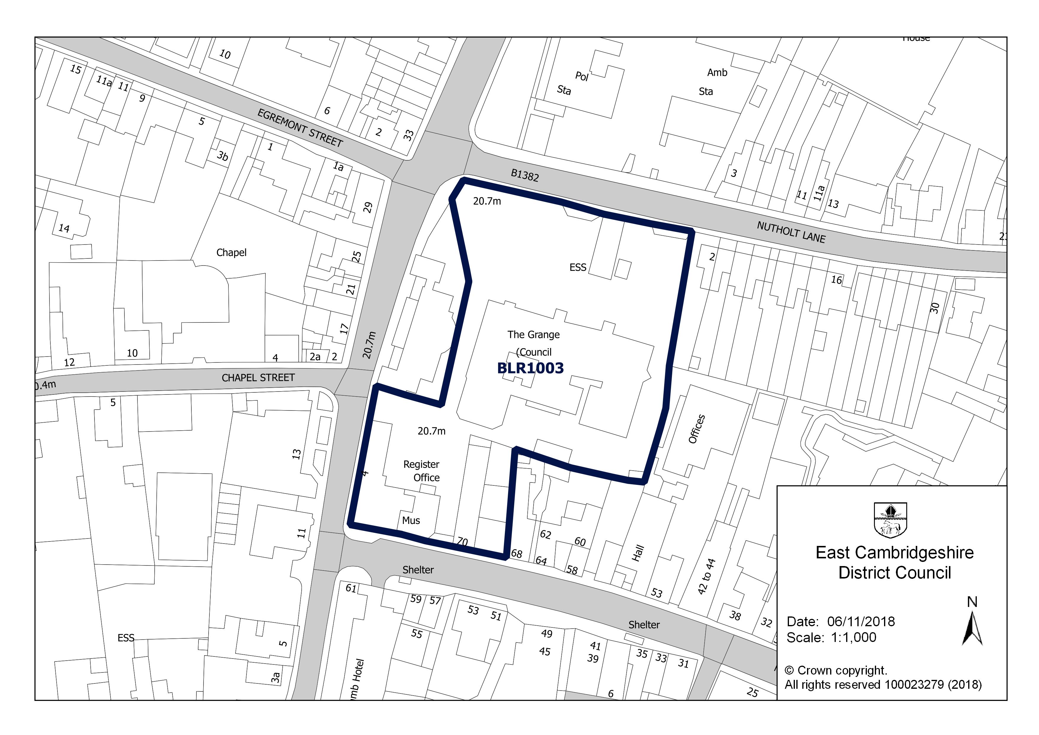
- The Grange, Nutholt Lane, Ely CB7 4EE: up to 10 homes, not permissioned (910 m)
- The Grange, Nutholt Lane, Ely CB7 4EE, not permissioned (910 m)
- Police/ Abulance Station, Nutholt Lane, Ely, CB7 4PL: up to 30 homes, not permissioned (940 m)
Roadworks
Finished in the last three months
- 16 September 2026 to 18 September 2026: ANGLIAN WATER, Utility repair and maintenance works, some carriageway incursion, on the footway (minor works)
Flood risk
Rivers, the sea or surface water: in this street's postcodes, 11 addresses are in areas at high risk, 6 at medium risk and 22 at low risk. Each address counts once, at the higher of its rivers-and-sea and surface-water risk.
Rivers and the sea alone: no home is in an area at risk.
High: 3.3% (1 in 30) or more chance of flooding a year. Medium: 1% to 3.3%. Low: 0.1% to 1%. Very low: under 0.1%. The rivers and sea figures allow for flood defences. Counts cover whole postcodes, which can include other streets.
Flood zone for planning: no postcode centre on this street is in flood zone 2 or 3.
| Postcode | Planning zone | Addresses at high / medium / low risk | Groundwater |
|---|---|---|---|
| CB6 3AT | not in 2 or 3 | 1 / 4 / 5 | unlikely |
| CB6 3AR | not in 2 or 3 | 0 / 0 / 0 | unlikely |
| CB6 3AS | not in 2 or 3 | 0 / 0 / 0 | unlikely |
| CB6 3AY | not in 2 or 3 | 10 / 2 / 10 | unlikely |
| CB6 3DA | not in 2 or 3 | 0 / 0 / 2 | unlikely |
| CB6 3WA | not in 2 or 3 | 0 / 0 / 5 | unlikely |
Broadband
| Postcode | Superfast (30 Mbit/s+) | Ultrafast (300 Mbit/s+) | Gigabit | Below 10 Mbit/s |
|---|---|---|---|---|
| CB6 3AR | 100% | 100% | 100% | 0% |
| CB6 3AS | 100% | 100% | 100% | 0% |
| CB6 3AT | 100% | 100% | 100% | 0% |
| CB6 3AY | 100% | 100% | 100% | 0% |
| CB6 3DA | 100% | 100% | 100% | 0% |
| CB6 3WA | 100% | 100% | 100% | 0% |
Nearest schools
| School | Phase | Ages | Distance | Inspection |
|---|---|---|---|---|
| Ely St John's Community Primary School | Primary | 4–11 | 610 m | No overall grade (Nov 2024, graded inspection without an overall judgement): Quality of education: Good; Behaviour and attitudes: Good; Personal development: Good; Leadership and management: Good |
| Ely College | Secondary | 11–18 | 840 m | No published inspection |
| Lantern Community Primary School | Primary | 3–11 | 1.0 km | No published inspection |
| Isle of Ely Primary School | Primary | 3–11 | 1.6 km | No published inspection |
| Spring Meadow Infant School | Primary | 4–7 | 1.9 km | Good (Mar 2024, overall grade under the previous framework) |
Food hygiene ratings nearby
| Business | Type | Distance | Rating | Rated |
|---|---|---|---|---|
| West End House CB6 3AY | Pub/bar/nightclub | 250 m | 5 Very good | 9 Aug 2018 |
| Lavender House Community Hub CB6 1AL | Restaurant/Cafe/Canteen | 490 m | 4 Good | 23 Feb 2024 |
Crime within 250 m
| Category | Crimes |
|---|---|
| Violence and sexual offences | 18 |
| Anti-social behaviour | 11 |
| Criminal damage and arson | 7 |
| Public order | 7 |
| Other theft | 3 |
| Other crime | 3 |
| Vehicle crime | 2 |
Most of these are attached to: On or near West Fen Road (11); On or near Goldsmith Court (10); On or near Hereward Street (9); On or near Hills Lane (8); On or near Walsingham Way (5).
What has changed
Nothing new since the change feed started on 30 October 2026. New sales and energy certificates, and hygiene ratings, school inspections and flood figures nearby, will be listed here as the sources update.
Postcodes on this street
- CB6 3AT: 31 addresses
- CB6 3AR: 21 addresses of 24 in the postcode
- CB6 3AS: 7 addresses of 8 in the postcode
- CB6 3AY: 1 address of 37 in the postcode
- CB6 3DA: 1 address of 22 in the postcode
- CB6 3WA: 1 address of 54 in the postcode
Nearby streets
St Ethelwolds Close · Walsingham Way · St Ovins Green · Cambridgeshire Close · Etheldreda Street · Debden Green · Beald Way · Hills Lane · Goldsmith Court · Darwin Close · Churchill Close · St Johns Road
All the streets in CB6 and across East Cambridgeshire.
What this page cannot tell you
- Whether a particular house is at risk of flooding, subsiding or anything else: the flood map is a model of areas and there is no property-level data here.
- What a home is worth now: sales are historic prices for the homes that happened to sell.
- How safe the street is: crime points are moved to anonymised locations and many crimes are never reported.
- Whether you would get a place at a school: distances are straight lines, not catchments.
- Anything about planning applications, roadworks, noise, air quality or council tax yet.
How each figure on this page is matched to the street and worked out: methodology.