Stour Green Ely, East Cambridgeshire
100 addresses across 5 postcodes (CB6), about 700 m long, classed as a local road. USRN 12004014.
- Sales: 228 recorded sales since 1995; in 2026 the median was £394,375 across 2 sales.
- Energy: 66 homes have an energy certificate (A: 2, C: 62, D: 2).
- Flood: 1 address on its postcodes is in areas at high or medium risk of flooding from rivers, the sea or surface water.
- Council tax: Most homes around it are in council tax band C; Band D in East Cambridgeshire costs £2,485 a year in 2026-27.
- Broadband: Gigabit broadband is available to 100% of premises.
- Transport: The nearest railway station is Ely, about 1.8 km away in a straight line.
- Green space: The nearest park or garden is about 50 m away.
- Air: Background air pollution in 2024 was 5.9 µg/m³ of nitrogen dioxide and 7.1 of PM2.5, within UK legal limits.
- Height: Its addresses are 14 to 21 m above sea level.
- Noise: 7 of its 100 addresses are modelled at 55 dB or more from road traffic.
- Doctors: The nearest GP surgery is St Mary's Surgery, about 1.1 km away, with 2 practices within 1.6 km.
- People: About 1,310 people lived in the census areas around it in 2021; 73% of households owned their home and 50% of adults held a degree or other higher qualification.
- Crime: 26 crimes were recorded within 250 m between September 2025 and August 2026, most often violence and sexual offences.
Sales on this street
| Year | Sales | Median price | Lowest | Highest |
|---|---|---|---|---|
| 2026 | 2 | £394,375 | £330,000 | £458,750 |
| 2025 | 6 | £414,975 | £300,000 | £580,000 |
| 2024 | 4 | £441,500 | £305,000 | £550,000 |
| 2023 | 6 | £432,500 | £352,500 | £568,750 |
| 2022 | 2 | £342,500 | £290,000 | £395,000 |
| 2021 | 4 | £478,750 | £357,500 | £555,000 |
| 2020 | 5 | £369,950 | £315,000 | £485,000 |
| 2019 | 5 | £280,000 | £246,000 | £540,000 |
| 2018 | 5 | £442,000 | £390,000 | £555,000 |
| 2017 | 6 | £354,998 | £293,500 | £400,000 |
| 2016 | 3 | £350,000 | £320,000 | £475,000 |
| 2015 | 10 | £293,750 | £197,950 | £475,000 |
| Date | Address | Type | Price | Notes |
|---|---|---|---|---|
| 26 Mar 2026 | 28 CB6 2WX | Terraced | £458,750 | |
| 27 Feb 2026 | 98 CB6 2XH | Terraced | £330,000 | |
| 9 Sep 2025 | 48 CB6 2WX | Terraced | £342,500 | |
| 28 Jul 2025 | 3 CB6 2WR | Detached | £552,500 | |
| 28 Mar 2025 | 21 CB6 2WR | Terraced | £379,950 | |
| 17 Feb 2025 | 49 CB6 2WR | Terraced | £450,000 | |
| 13 Feb 2025 | 92 CB6 2XH | Terraced | £300,000 | |
| 16 Jan 2025 | 29 CB6 2WR | Detached | £580,000 | |
| 6 Dec 2024 | 1 CB6 2WR | Detached | £475,000 | |
| 28 Jun 2024 | 73 CB6 2XJ | Terraced | £305,000 | |
| 27 Jun 2024 | 73 CB6 2XJ | Terraced | £295,000 | Not a standard sale (repossession, buy-to-let or transfer). |
| 30 Jan 2024 | 119 CB6 2XJ | Detached | £550,000 | |
| 29 Jan 2024 | 27 CB6 2WR | Semi-detached | £408,000 | |
| 7 Dec 2023 | 43 CB6 2WR | Terraced | £365,000 | |
| 20 Nov 2023 | 12 CB6 2WR | Detached | £500,000 | |
| 20 Oct 2023 | 96 CB6 2XH | Terraced | £352,500 | |
| 5 Jun 2023 | 5 CB6 2WR | Detached | £568,750 | |
| 19 May 2023 | 132 CB6 2XH | Terraced | £360,000 | |
| 16 May 2023 | 117 CB6 2XJ | Detached | £535,000 | |
| 28 Jul 2022 | 27 CB6 2WR | Semi-detached | £395,000 | |
| 16 Jun 2022 | 113 CB6 2XJ | Semi-detached | £290,000 | |
| 29 Jun 2021 | 68 CB6 2WX | Detached | £437,500 | |
| 21 Jun 2021 | 21 CB6 2WR | Terraced | £357,500 | |
| 7 May 2021 | 29 CB6 2WR | Detached | £555,000 | |
| 5 Mar 2021 | 112 CB6 2XH | Detached | £520,000 | |
| 15 Jul 2020 | 114 CB6 2XH | Semi-detached | £477,000 | |
| 7 May 2020 | 52 CB6 2WX | Detached | £190,000 | Not a standard sale (repossession, buy-to-let or transfer). |
| 6 May 2020 | 67 CB6 2XJ | Terraced | £260,000 | Not a standard sale (repossession, buy-to-let or transfer). |
| 26 Mar 2020 | 21 CB6 2WR | Terraced | £317,000 | |
| 11 Mar 2020 | 121 CB6 2XJ | Detached | £485,000 | |
| 28 Feb 2020 | 47 CB6 2WR | Terraced | £315,000 | |
| 31 Jan 2020 | 28 CB6 2WX | Terraced | £369,950 | |
| 20 Dec 2019 | 83 CB6 2XJ | Terraced | £250,000 | Not a standard sale (repossession, buy-to-let or transfer). |
| 20 Dec 2019 | 83 CB6 2XJ | Terraced | £250,000 | |
| 8 Oct 2019 | 113 CB6 2XJ | Semi-detached | £246,000 | |
| 2 Aug 2019 | 48 CB6 2WX | Terraced | £280,000 | |
| 7 Jun 2019 | 112 CB6 2XH | Detached | £540,000 | |
| 1 May 2019 | 105 CB6 2XJ | Semi-detached | £430,000 | |
| 27 Sep 2018 | 9 CB6 2WR | Semi-detached | £450,000 | |
| 17 Aug 2018 | 2 CB6 2WR | Detached | £442,000 | |
| 24 Jul 2018 | 78 CB6 2XH | Detached | £422,500 | |
| 1 Jun 2018 | 10 CB6 2WR | Detached | £390,000 | |
| 31 Jan 2018 | 103 CB6 2XJ | Detached | £555,000 | |
| 18 Oct 2017 | 63 CB6 2XJ | Terraced | £300,000 | |
| 19 Apr 2017 | 72 CB6 2WX | Detached | £380,000 | |
| 12 Apr 2017 | 17 CB6 2WR | Detached | £400,000 | |
| 27 Feb 2017 | 87 CB6 2XJ | Semi-detached | £370,000 | |
| 20 Feb 2017 | 22 CB6 2WX | Terraced | £339,995 | |
| 10 Feb 2017 | 90 CB6 2XH | Terraced | £293,500 | |
| 2 Dec 2016 | 31 CB6 2WR | Detached | £475,000 |
Energy performance certificates
66 homes with a current certificate; median floor area 113 m². Most common: House, detached (23); House, mid-terrace (20); House, semi-detached (12). Built: 2003-2006 (57); 1996-2002 (6); 2007-2011 (2). Tenure at assessment: owner-occupied (38); rented (private) (12).
Council tax
What each band costs in East Cambridgeshire in 2026-27: Band D £2,485 a year on average, including the police, fire and any county and parish charges.
| A | B | C | D | E | F | G | H |
|---|---|---|---|---|---|---|---|
| £1,657 | £1,933 | £2,209 | £2,485 | £3,037 | £3,590 | £4,142 | £4,970 |
Homes by band in the neighbourhood around this street: most are in band C (26% of about 940 homes).
Planning and heritage
- Conservation area: no postcode centre in this street's postcodes is in one.
- Listed buildings on or by this street: none.
- Article 4 direction (removing permitted development rights): none recorded, though not every council has published theirs.
- Tree preservation orders: none recorded, though not every council has published theirs.
- Green belt: no.
Brownfield land registered for housing within 1.0 km
- Balagowan 34 Downham Road Ely Cambridgeshire CB6 1BL: up to 1 home, pending decision (590 m)
- Swimming Pool Newnham Street Ely Cambridgeshire CB7 4PQ: up to 13 homes, permissioned (680 m)
- Police/ Abulance Station, Nutholt Lane, Ely, CB7 4PL: up to 30 homes, not permissioned (680 m)
- Paradise Leisure Centre, Newnham St, Ely CB7 4PQ: up to 50 homes, not permissioned (700 m)
- Paradise Leisure Centre, Newnham St, Ely CB7 4PQ, not permissioned (700 m)
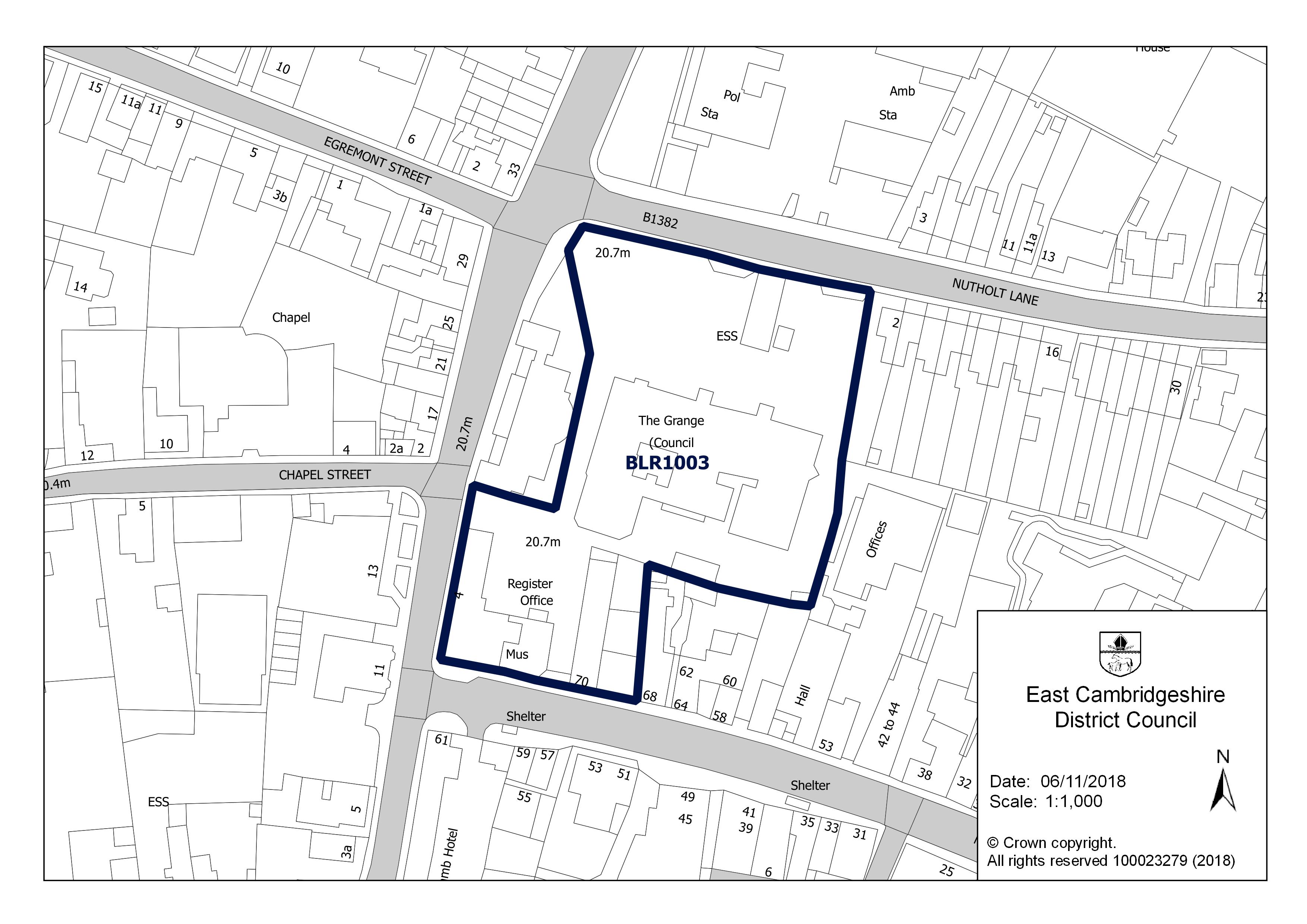
- The Grange, Nutholt Lane, Ely CB7 4EE: up to 10 homes, not permissioned (750 m)
- The Grange, Nutholt Lane, Ely CB7 4EE, not permissioned (750 m)
- Waitrose Car Park area, Brays Lane, Ely, CB7 4QJ: up to 20 homes, not permissioned (860 m)

Roadworks
No street works under way, planned or finished in the last three months on this street, in permits up to 30 September 2026.
Flood risk
Rivers, the sea or surface water: in this street's postcodes, 1 address is in areas at high risk, 0 at medium risk and 11 at low risk. Each address counts once, at the higher of its rivers-and-sea and surface-water risk.
Rivers and the sea alone: no home is in an area at risk.
High: 3.3% (1 in 30) or more chance of flooding a year. Medium: 1% to 3.3%. Low: 0.1% to 1%. Very low: under 0.1%. The rivers and sea figures allow for flood defences. Counts cover whole postcodes, which can include other streets.
Flood zone for planning: no postcode centre on this street is in flood zone 2 or 3.
| Postcode | Planning zone | Addresses at high / medium / low risk | Groundwater |
|---|---|---|---|
| CB6 2XJ | not in 2 or 3 | 0 / 0 / 2 | unlikely |
| CB6 2XH | not in 2 or 3 | 0 / 0 / 0 | unlikely |
| CB6 2WR | not in 2 or 3 | 0 / 0 / 4 | unlikely |
| CB6 2WX | not in 2 or 3 | 1 / 0 / 5 | unlikely |
| CB6 2WZ | not in 2 or 3 | 0 / 0 / 0 | unlikely |
Height above sea level
The street's 100 addresses are between 14 m and 21 m above sea level (17 m on average); the ground rises about 7 m from the lowest to the highest.
Broadband
| Postcode | Superfast (30 Mbit/s+) | Ultrafast (300 Mbit/s+) | Gigabit | Below 10 Mbit/s |
|---|---|---|---|---|
| CB6 2WR | 100% | 100% | 100% | 0% |
| CB6 2WX | 100% | 100% | 100% | 0% |
| CB6 2WZ | 100% | 100% | 100% | 0% |
| CB6 2XH | 100% | 100% | 100% | 0% |
| CB6 2XJ | 100% | 100% | 100% | 0% |
Getting around
| Nearest | Distance | |
|---|---|---|
| Railway stations | Ely 2.3 million journeys in 2024–25 | 1.8 km |
| Littleport 252,000 journeys in 2024–25 | 7.1 km | |
| Soham 66,000 journeys in 2024–25 | 9.3 km | |
| Bus stops | 5 stops within 400 m, 32 within 800 m; nearest Stour Green Ely | 250 m |
| Car parks | Forehill Car Park | 1.2 km |
| EV charging points | 6 within 1.6 km; nearest Newnham Street Car Park | 730 m |
| Airport with scheduled flights | London Stansted Airport STN | 58.2 km |
Local services
| Nearest | Distance | |
|---|---|---|
| GP surgeries | 2 practices within 1.6 km; nearest St Mary's Surgery | 1.1 km |
| Pharmacies | 3 pharmacies within 1.6 km; nearest Boots | 910 m |
| NHS dentists | 5 practices within 1.6 km; nearest Dental Surgery | 850 m |
| Hospital | Princess Of Wales Hospital | 1.1 km |
| Police station | Ely Police Station | 690 m |
| Cash machines | Cashpoint® Minster Place Lloyds Bank | 900 m |
Parks and green space
| Nearest | Distance | |
|---|---|---|
| Park or garden | 2 within 800 m; nearest Unnamed 1.2 ha | 50 m |
| Play area | 4 within 800 m; nearest Unnamed 800 m² | 630 m |
| Playing field | 1 within 800 m; nearest Unnamed 5,710 m² | 780 m |
| Allotments | 2 within 800 m; nearest Unnamed 3.0 ha | 630 m |
Within 800 m: 2 parks and gardens, 2.1 hectares in all.
Landmarks
The nearest historic landmark is Sessions House, a listed building (Grade II*), 740 m south. 86 listed buildings are within 1.0 km, 4 of them Grade I and 5 of them Grade II*.
| Name | What it is | From the middle of the street |
|---|---|---|
| Sessions House | Listed building, Grade II* | 740 m south |
| The Chantry | Listed building, Grade II* | 910 m south |
| 3 Palace Green | Listed building, Grade II* | 920 m south |
| Nos. 16 and 18 High Street (including Steeple Gate) | Listed building, Grade II* | 920 m south |
| Ely Cathedral: claustral buildings | Scheduled monument | 1.0 km south |
| Hospital of St John the Baptist and St Mary Magdalene, St John's Farm | Scheduled monument | 1.2 km south-west |
| 'Cherry Hill', castle mound | Scheduled monument | 1.3 km south |
| Name | What it is | From the middle of the street |
|---|---|---|
| Roswell Pits | Lake or reservoir | 1.6 km east |
| Redmoor Plantation | Wood | 2.7 km north-east |
| Quanea Hill | Hill | 3.6 km south-east |
| Brick Hill | Hill | 3.6 km north-east |
| The Rookery | Wood | 4.0 km north-west |
| Thorney Hill | Hill | 4.2 km south-east |
Air quality
| Pollutant | Here | UK limit | WHO guideline |
|---|---|---|---|
| Nitrogen dioxide (NO2) | 5.9 | 40 | 10 |
| Fine particles (PM2.5) | 7.1 | 20 | 5 |
| Particles (PM10) | 12.7 | 40 | 15 |
All three are within the UK legal limits; PM2.5 is above the WHO guideline, as in most towns and cities.
Road and rail noise
| Level | Road traffic | Railways |
|---|---|---|
| 55 to 59 | 7 | 0 |
| Under 55 | 93 | 100 |
7 of the street's 100 addresses are modelled at 55 dB or more from road traffic, above the WHO guidelines.
Nearest schools
| School | Phase | Ages | Distance | Inspection |
|---|---|---|---|---|
| Lantern Community Primary School | Primary | 3–11 | 160 m | No published inspection |
| Ely College | Secondary | 11–18 | 330 m | No published inspection |
| Isle of Ely Primary School | Primary | 3–11 | 450 m | No published inspection |
| Spring Meadow Infant School | Primary | 4–7 | 1.0 km | Good (Mar 2024, overall grade under the previous framework) |
| Ely St Mary's CofE Junior School Church of England | Primary | 7–11 | 1.0 km | Good (Apr 2023, overall grade under the previous framework) |
| Ely St John's Community Primary School | Primary | 4–11 | 1.7 km | No overall grade (Nov 2024, graded inspection without an overall judgement): Quality of education: Good; Behaviour and attitudes: Good; Personal development: Good; Leadership and management: Good |
Food hygiene ratings nearby
| Business | Type | Distance | Rating | Rated |
|---|---|---|---|---|
| Out Of School Club CB6 1BD | Hospitals/Childcare/Caring Premises | 400 m | 5 Very good | 16 Nov 2021 |
| The Orchards CB6 2FU | Hospitals/Childcare/Caring Premises | 410 m | 5 Very good | 14 Jul 2026 |
| Lily House CB6 1DE | Hospitals/Childcare/Caring Premises | 430 m | 5 Very good | 21 Nov 2025 |
| Taylorshaw @ Isle Of Ely Primary School CB6 2FG | School/college/university | 430 m | 5 Very good | 7 Nov 2024 |
| Premier Wraparound Club At Isle Of Ely Primary School CB6 2FG | Hospitals/Childcare/Caring Premises | 430 m | 1 Major improvement necessary | 29 Sep 2026 |
| Nature Gnomes CB6 2FG | Mobile caterer | 430 m | Awaiting inspection | |
| Ely Beet Sports & Social Club CB6 1DD | Other catering premises | 500 m | 5 Very good | 21 Jan 2022 |
Crime within 250 m
| Category | Crimes |
|---|---|
| Violence and sexual offences | 16 |
| Anti-social behaviour | 7 |
| Other theft | 2 |
| Public order | 1 |
Most of these are attached to: On or near Nene Road (16); On or near Welland Place (6); On or near Stour Green (4).
People and work
Who lives here
| Around this street | England | |
|---|---|---|
| Median age | 37 | 40 |
| Children under 15 | 25% | 17% |
| Aged 65 and over | 8% | 18% |
Homes
| Around this street | England | |
|---|---|---|
| Owned (outright or with a mortgage) | 73% | 61% |
| Owned outright | 21% | 33% |
| Shared ownership | 1% | 1% |
| Social rented | 9% | 17% |
| Private rented | 16% | 21% |
Work and commuting
| Around this street | England | |
|---|---|---|
| Adults (16 and over) in work | 74% | 57% |
| Unemployment (of those working or looking for work) | 5% | 6% |
| Retired (of adults) | 10% | 22% |
| Long-term sick or disabled (of adults) | 2% | 4% |
| Work mainly from home (of those in work) | 47% | 32% |
| Travel to work by car or van | 38% | 48% |
| By train, Underground, metro or tram | 5% | 4% |
| By any public transport, including bus | 5% | 8% |
| On foot or by bicycle | 10% | 10% |
| Work within 10 km of home (of those who travel to work) | 46% | 65% |
| Work 30 km or more away | 13% | 8% |
Education and languages
| Around this street | England | |
|---|---|---|
| Degree or other higher qualification, Level 4+ (of adults) | 50% | 34% |
| No qualifications | 8% | 18% |
| Apprenticeship as highest qualification | 3% | 5% |
| Main language English (aged 3 and over) | 94% | 91% |
| Cannot speak English well or at all | under 1% | 2% |
Deprivation
The neighbourhood around this street is in decile 10 of 10 on the English Indices of Deprivation 2025, where 1 is the most deprived tenth of England's 33,755 neighbourhoods and 10 the least.
What has changed
Nothing new since the change feed started on 30 October 2026. New sales and energy certificates, and hygiene ratings, school inspections and flood figures nearby, will be listed here as the sources update.
Postcodes on this street
- CB6 2XJ: 34 addresses of 36 in the postcode
- CB6 2XH: 31 addresses of 32 in the postcode
- CB6 2WR: 24 addresses of 47 in the postcode
- CB6 2WX: 10 addresses of 27 in the postcode
- CB6 2WZ: 1 address of 20 in the postcode
Nearby streets
The Medway · Stour Green · Chelmer Way · Nene Road · Dalton Way · St Audreys Way · Wensum Way · Quince Way · Bright Street · Rosehip Chase · St Audrey's Way · Meldon Place
All the streets in CB6 and across East Cambridgeshire.
What this page cannot tell you
- Whether a particular house is at risk of flooding, subsiding or anything else: the flood map is a model of areas and there is no property-level data here.
- What a home is worth now: sales are historic prices for the homes that happened to sell.
- How safe the street is: crime points are moved to anonymised locations and many crimes are never reported.
- Whether you would get a place at a school: distances are straight lines, not catchments.
- Who lives on the street now: census figures describe the small areas around it in March 2021, during a lockdown.
- How long a journey takes or how often anything runs: transport distances are straight lines to the nearest stops.
- Whether a GP practice is taking new patients, or a dentist new NHS patients.
- How loud a home is inside, or noise from aircraft, industry or neighbours: noise figures are models of road and rail traffic outside, in England only.
How each figure on this page is matched to the street and worked out: methodology.